Walking the landscape—catchment stories—Lower Brisbane Catchment
To effectively manage a catchment it is important to have a collective understanding of how the catchment works. Catchment stories, using map journals, integrate spatial information, photographs and animations with an informative narrative to demonstrate the features of catchments.
This story describe the location, extent and values of the Lower Brisbane Catchment. It demonstrates the key features which influence water flow, including geology, topography, rainfall and run-off, natural features, human modifications and land uses.
The information was complied using the walking the landscape process, where experts systematically worked through a catchment in a facilitated workshop, to incorporate diverse knowledge on the landscape and to develop catchment stories. Others stories are under development, so watch this space!
Shorebirds locations in Queensland
Queensland contains around a quarter of Australia’s shorebirds and an estimated population of 400,000 occur along the Queensland coastline from the Gulf of Carpentaria to the south east corner. Information on bird locations on the Queensland coast has been provided in partnership with Queensland Parks and Wildlife Service, researchers and volunteers from the Australasian Wader Study Group, Queensland Wader Study Group, Birds Queensland, the Port Curtis Wader Study Group, the Wildlife Preservation Society of Queensland, Birds Australia and the Mackay Conservation Group.
The User defined fact sheet tool allows users to create their own Queensland Wetland Program fact sheet based on their needs and the parts of site which are relevant to them. They use a site map and then click the relevant sections they want which is then placed in a PDF format. The fact sheet can be added to by stakeholders to include their organisation, an overall summary or explanation of the fact sheet purpose, additional information and links. The User defined fact sheet may also be used by more regular WetlandInfo users who would prefer a list of links to the tools they may need to access.
The WetlandUpdate is a regular bulletin sent to subscribers to provide them with the latest WetlandInfo resources and tools, as well as case studies, video information and new project fact sheets.
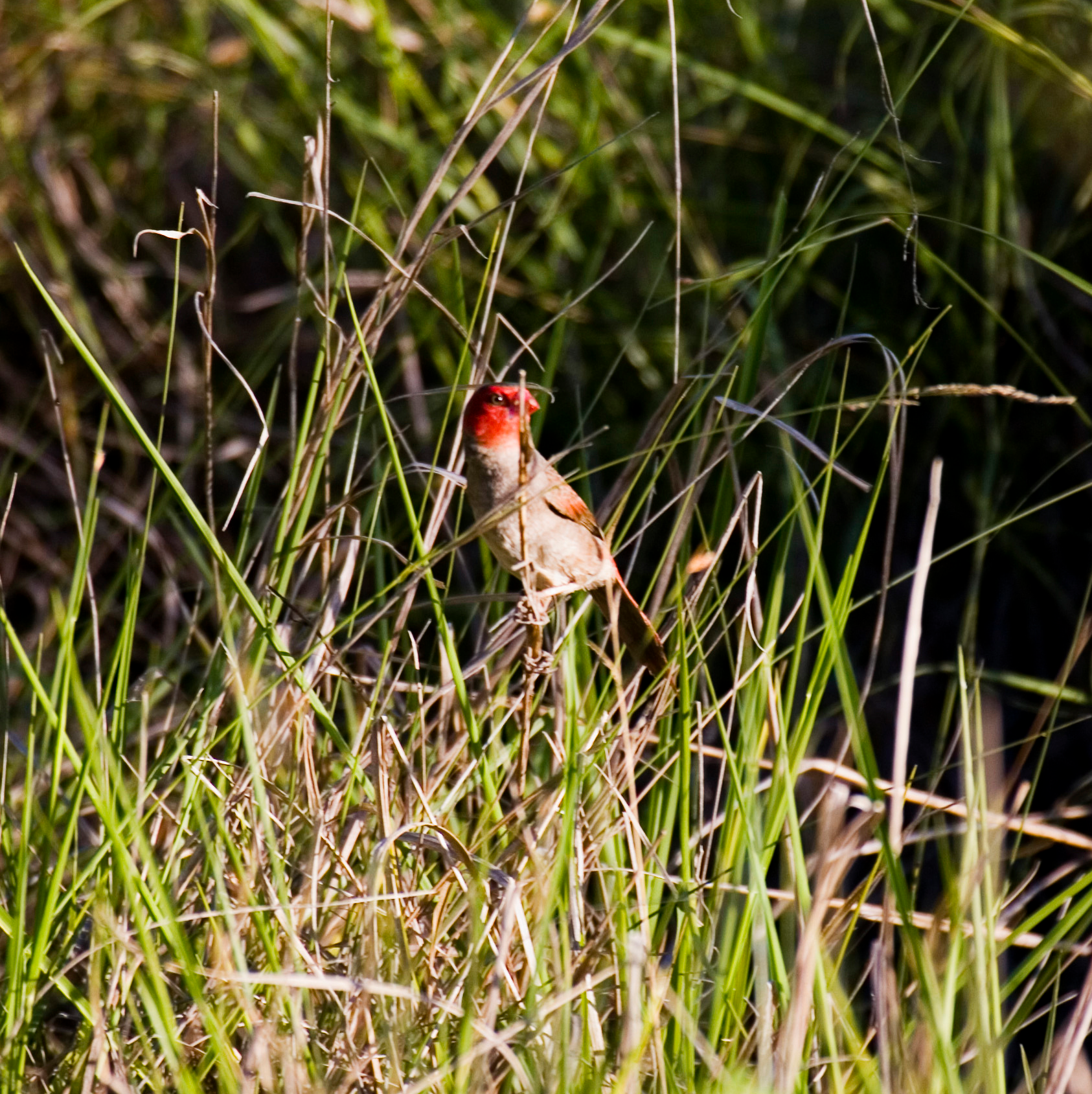
Our WetlandInfo feature bird is Neochmia phaeton evangelinae, the crimson finch (white-bellied subspecies). The crimson finch (white-bellied subspecies) is listed as Endangered in Queensland (Nature Conservation Act 1992) and Vulnerable nationally (Commonwealth Environment Protection and Biodiversity Conservation Act 1999). It is ranked as a high priority under the Department of Environment and Heritage Protection Back on Track species prioritisation framework.
WetlandInfo updates this section regularly, so stay tuned for more!
Department of the Environment, Tourism, Science and Innovation, Queensland (2017) WetlandUpdate July 2017, WetlandInfo website, accessed 11 March 2026. Available at: https://wetlandinfo.detsi.qld.gov.au/wetlands/resources/publications/latest-news/2017-06-23.html


 — Department of the Environment, Tourism, Science and Innovation