

|
|
Bowling Green Bay Ramsar internationally important wetlandAccess wetland mapping in PDF and KML format by selecting the desired 100K map tile below or download the data via the Queensland Government Information Service. The below map is for visual representation purposes only. For more detailed mapping, please download the boundary KML. Drag this bar to relocate the map on your screen Open WetlandMaps interactive map server
Overview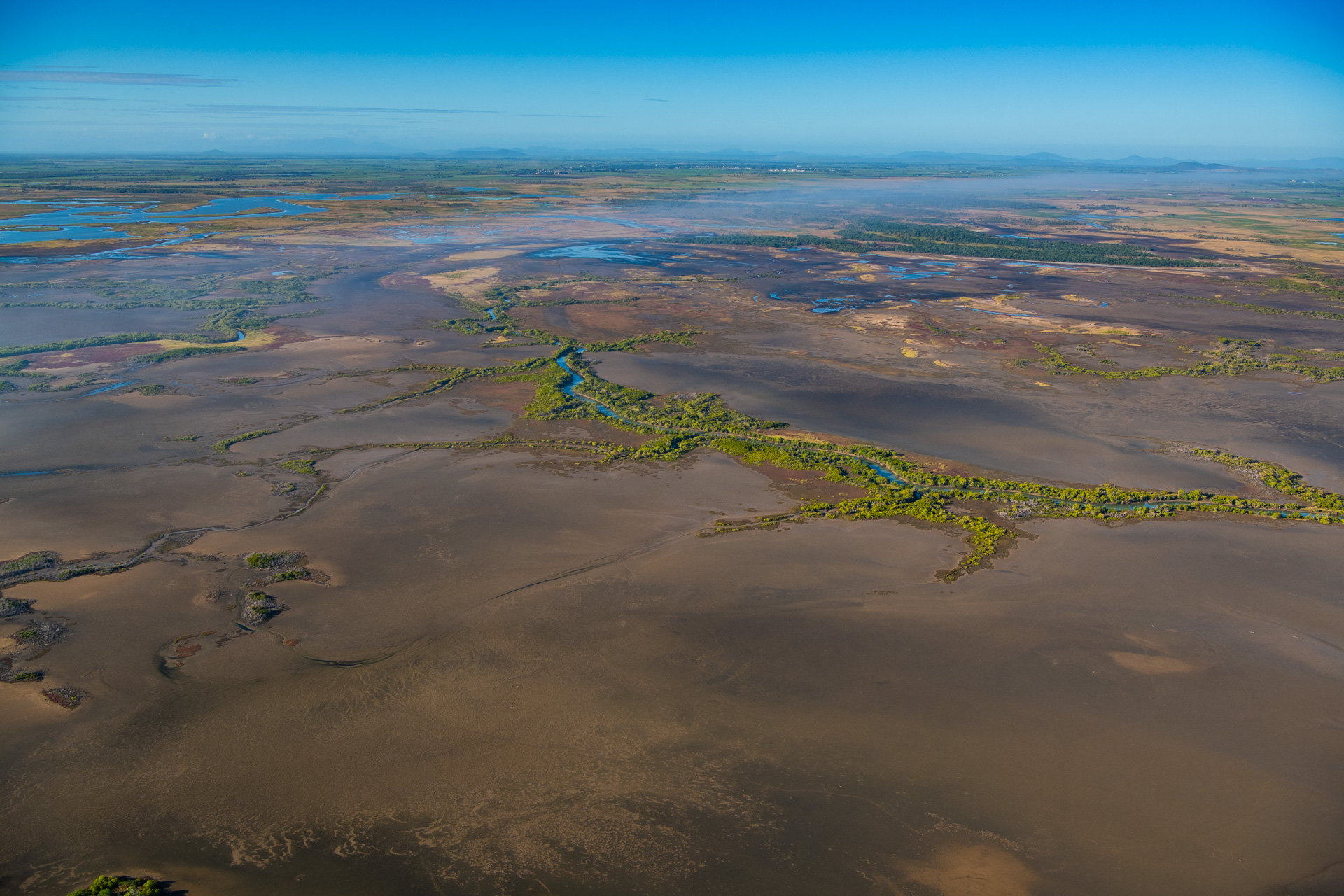 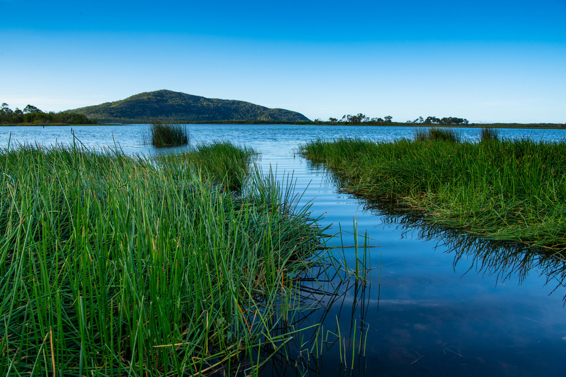 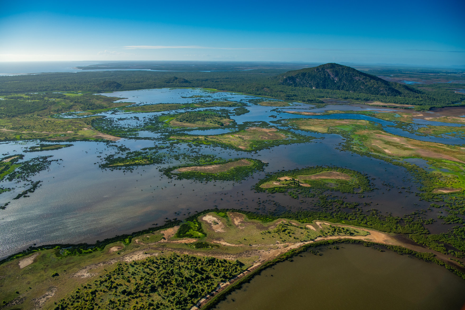 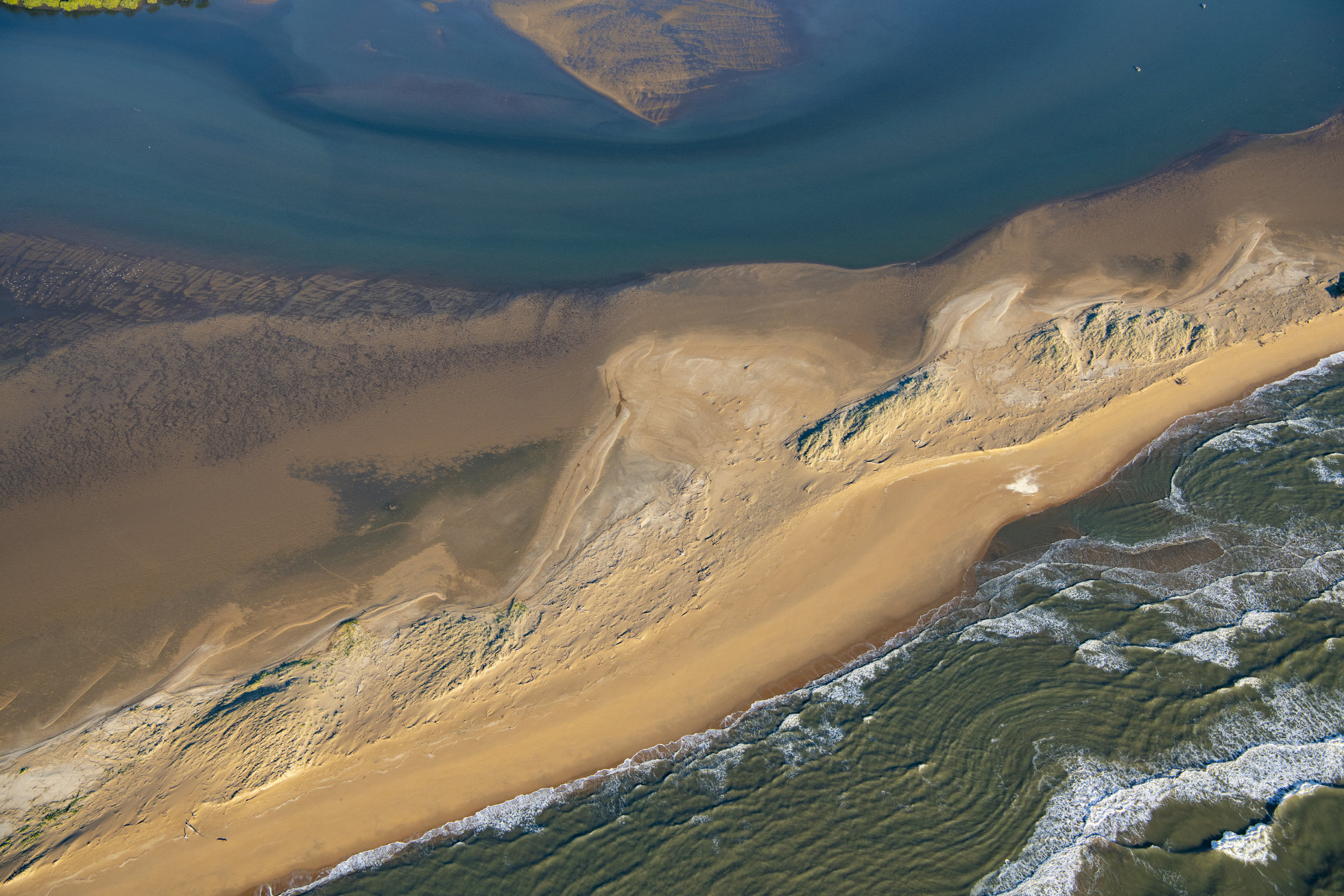 Bowling Green Bay was listed as a Ramsar site on 22 October 1993, and is located on Queensland’s coast just south of Townsville. Covering more than 36,000 ha, the Bowling Green Bay Ramsar site includes a diverse number of wetland types comprising palustrine, riverine, estuarine and marine wetlands. Complex patterns of saltmarsh and saltwater couch grasslands back onto thin fringes of low Rhizophora mangrove communities in the intertidal zone. The site contains rich coastal habitats that are representative of Australia's north-east, coastal wet-dry tropics, including one of the largest mangrove and saltmarsh habitats along the Great Barrier Reef (GBR) Coast. The site is home to rich and varied bird life – including many migratory shorebirds, and supports an abundance of species including turtles and other waterbirds, and contains valuable fish habitat. It is culturally and spiritually significant for the Bindal People and the Wulgurukaba People and is also important for scientific research and recreational activities. The Bowling Green Bay Ramar Information Sheet (RIS) describes the boundary of the site and outlines the justification for listing. The RIS also describes the ecological character, threats, conservation measures and use of the site. The lowland section of the site falls within the Bowling Green Bay National Park while other areas fall within the Bowling Green Bay Conservation Park boundary. Relevant protected area management plans can be found here. Protecting and managing the Ramsar site requires a collaborative effort. The State works with both Federal and local governments along with natural resource management groups, First Nations people, landholders, industry and the community to care for the site and the values it supports. This often involves conducting management activities in the surrounding areas that impact upon the Ramsar site and its values. Additional resources can be found at the following links:
Wetlands International provides a Ramsar Sites: Directory and Overview for preparing reports on specific aspects of the site. Catchment stories
|
| System | Area (ha) | % wetlands area | % total area |
|---|---|---|---|
| Total | 26,774 | 100.0% | 73.0% |
| Total excluding riverine and artificial/highly modified riverine | 26,754 | 99.9% | 73.0% |
| Artificial and highly modified | 0 | 0.0% | 0.0% |
| Intertidal (saltmarsh, saltflats, mangroves) (natural) | 26,135 | 97.6% | 71.3% |
| Intertidal (saltmarsh, saltflats, mangroves) (slightly modified) | 76 | 0.3% | 0.2% |
| Lacustrine (natural) | 0 | 0.0% | 0.0% |
| Lacustrine (slightly modified) | 0 | 0.0% | 0.0% |
| Lacustrine (unknown degree of modification) | 0 | 0.0% | 0.0% |
| Palustrine (natural) | 366 | 1.4% | 1.0% |
| Palustrine (slightly modified) | 177 | 0.7% | 0.5% |
| Riverine | 20 | 0.1% | 0.1% |
| Intertidal (saltmarsh, saltflats, mangroves) (highly modified) | 0 | 0.0% | 0.0% |
| Intertidal (saltmarsh, saltflats, mangroves) (natural) | 26,135 | 97.6% | 71.3% |
| Intertidal (saltmarsh, saltflats, mangroves) (slightly modified) | 76 | 0.3% | 0.2% |
| Lacustrine (artificial) | 0 | 0.0% | 0.0% |
| Lacustrine (highly modified) | 0 | 0.0% | 0.0% |
| Lacustrine (natural) | 0 | 0.0% | 0.0% |
| Lacustrine (slightly modified) | 0 | 0.0% | 0.0% |
| Lacustrine (unknown degree of modification) | 0 | 0.0% | 0.0% |
| Palustrine (artificial) | 0 | 0.0% | 0.0% |
| Palustrine (highly modified) | 0 | 0.0% | 0.0% |
| Palustrine (natural) | 366 | 1.4% | 1.0% |
| Palustrine (slightly modified) | 177 | 0.7% | 0.5% |
| Riverine (artificial) | 0 | 0.0% | 0.0% |
| Riverine (highly modified) | 0 | 0.0% | 0.0% |
| Riverine (natural) | 20 | 0.1% | 0.1% |
| Riverine (slightly modified) | 0 | 0.0% | 0.0% |
For definitions of artificial, highly modified, modified, slightly modified and natural wetlands, see the Queensland Wetland Mapping Method - A Method to Provide Baseline Mapping of Wetland Extent and Changes in Wetland Extent in Queensland.
| Habitat | Area (ha) | % wetlands area | % total area |
|---|---|---|---|
| Total | 15,732 | 100.0% | 42.9% |
| Mangroves - Casuarina | 0 | 0.0% | 0.0% |
| Mangroves - other | 11,449 | 72.8% | 31.2% |
| Salt marsh and salt flats | 3,749 | 23.8% | 10.2% |
| Arid and semi-arid saline lake | 0 | 0.0% | 0.0% |
| Arid and semi-arid floodplain lake | 0 | 0.0% | 0.0% |
| Arid and semi-arid permanently inundated lake | 0 | 0.0% | 0.0% |
| Coastal and sub-coastal floodplain lake | 0 | 0.0% | 0.0% |
| Coastal and sub-coastal non-floodplain rock lake | 0 | 0.0% | 0.0% |
| Coastal and sub-coastal non-floodplain sand (window) lake | 0 | 0.0% | 0.0% |
| Coastal and sub-coastal non-floodplain sand (perched) lake | 0 | 0.0% | 0.0% |
| Coastal and sub-coastal non-floodplain soil lake | 0 | 0.0% | 0.0% |
| Arid and semi-arid saline swamp | 0 | 0.0% | 0.0% |
| Arid and semi-arid floodplain tree swamp | 0 | 0.0% | 0.0% |
| Arid and semi-arid floodplain shrub swamp | 0 | 0.0% | 0.0% |
| Arid and semi-arid floodplain grass, sedge and herb swamp | 0 | 0.0% | 0.0% |
| Arid and semi-arid non-floodplain tree swamp | 0 | 0.0% | 0.0% |
| Arid and semi-arid non-floodplain shrub swamp | 0 | 0.0% | 0.0% |
| Arid and semi-arid non-floodplain grass, sedge and herb swamp | 0 | 0.0% | 0.0% |
| Arid and semi-arid other non-floodplain swamp | 0 | 0.0% | 0.0% |
| Arid and semi-arid Great Artesian Basin fed spring swamp | 0 | 0.0% | 0.0% |
| Coastal and sub-coastal non-floodplain tree (Melaleuca and Eucalypt) swamp | 90 | 0.6% | 0.2% |
| Coastal and sub-coastal non-floodplain wet heath swamp | 0 | 0.0% | 0.0% |
| Coastal and sub-coastal non-floodplain grass, sedge, and herb swamp | 92 | 0.6% | 0.3% |
| Coastal and sub-coastal other non-floodplain swamp | 0 | 0.0% | 0.0% |
| Coastal and sub-coastal floodplain tree (Melaleuca and Eucalypt) swamp | 113 | 0.7% | 0.3% |
| Coastal and sub-coastal floodplain grass, sedge, and herb swamp | 240 | 1.5% | 0.7% |
| Coastal and sub-coastal floodplain wet heath swamp | 0 | 0.0% | 0.0% |
| Coastal and sub-coastal other floodplain swamp | 0 | 0.0% | 0.0% |
| Coastal and sub-coastal tree (palm) swamp | 0 | 0.0% | 0.0% |
| Unknown - Swamp - Arid and semi-arid | 0 | 0.0% | 0.0% |
| Unknown - Swamp - Coastal and sub-coastal | 0 | 0.0% | 0.0% |
| Mangroves - Casuarina (natural) | 0 | 0.0% | 0.0% |
| Mangroves - Casuarina (slightly modified) | 0 | 0.0% | 0.0% |
| Mangroves - other (natural) | 11,449 | 72.8% | 31.2% |
| Mangroves - other (slightly modified) | 0 | 0.0% | 0.0% |
| Salt marsh and salt flats (natural) | 3,673 | 23.3% | 10.0% |
| Salt marsh and salt flats (slightly modified) | 76 | 0.5% | 0.2% |
| Arid and semi-arid saline lake (natural) | 0 | 0.0% | 0.0% |
| Arid and semi-arid saline lake (slightly modified) | 0 | 0.0% | 0.0% |
| Arid and semi-arid floodplain lake (natural) | 0 | 0.0% | 0.0% |
| Arid and semi-arid floodplain lake (slightly modified) | 0 | 0.0% | 0.0% |
| Arid and semi-arid permanently inundated lake (slightly modified) | 0 | 0.0% | 0.0% |
| Coastal and sub-coastal floodplain lake (natural) | 0 | 0.0% | 0.0% |
| Coastal and sub-coastal floodplain lake (slightly modified) | 0 | 0.0% | 0.0% |
| Coastal and sub-coastal non-floodplain rock lake (natural) | 0 | 0.0% | 0.0% |
| Coastal and sub-coastal non-floodplain rock lake (slightly modified) | 0 | 0.0% | 0.0% |
| Coastal and sub-coastal non-floodplain sand (window) lake (natural) | 0 | 0.0% | 0.0% |
| Coastal and sub-coastal non-floodplain sand (window) lake (slightly modified) | 0 | 0.0% | 0.0% |
| Coastal and sub-coastal non-floodplain sand (perched) lake (natural) | 0 | 0.0% | 0.0% |
| Coastal and sub-coastal non-floodplain soil lake (natural) | 0 | 0.0% | 0.0% |
| Coastal and sub-coastal non-floodplain soil lake (slightly modified) | 0 | 0.0% | 0.0% |
| Arid and semi-arid saline swamp (natural) | 0 | 0.0% | 0.0% |
| Arid and semi-arid saline swamp (slightly modified) | 0 | 0.0% | 0.0% |
| Arid and semi-arid floodplain tree swamp (natural) | 0 | 0.0% | 0.0% |
| Arid and semi-arid floodplain tree swamp (slightly modified) | 0 | 0.0% | 0.0% |
| Arid and semi-arid floodplain shrub swamp (natural) | 0 | 0.0% | 0.0% |
| Arid and semi-arid floodplain shrub swamp (slightly modified) | 0 | 0.0% | 0.0% |
| Arid and semi-arid floodplain grass, sedge and herb swamp (natural) | 0 | 0.0% | 0.0% |
| Arid and semi-arid floodplain grass, sedge and herb swamp (slightly modified) | 0 | 0.0% | 0.0% |
| Arid and semi-arid non-floodplain tree swamp (natural) | 0 | 0.0% | 0.0% |
| Arid and semi-arid non-floodplain tree swamp (slightly modified) | 0 | 0.0% | 0.0% |
| Arid and semi-arid non-floodplain shrub swamp (natural) | 0 | 0.0% | 0.0% |
| Arid and semi-arid non-floodplain shrub swamp (slightly modified) | 0 | 0.0% | 0.0% |
| Arid and semi-arid non-floodplain grass, sedge and herb swamp (natural) | 0 | 0.0% | 0.0% |
| Arid and semi-arid non-floodplain grass, sedge and herb swamp (slightly modified) | 0 | 0.0% | 0.0% |
| Arid and semi-arid other non-floodplain swamp (natural) | 0 | 0.0% | 0.0% |
| Arid and semi-arid other non-floodplain swamp (slightly modified) | 0 | 0.0% | 0.0% |
| Arid and semi-arid Great Artesian Basin fed spring swamp (natural) | 0 | 0.0% | 0.0% |
| Arid and semi-arid Great Artesian Basin fed spring swamp (slightly modified) | 0 | 0.0% | 0.0% |
| Coastal and sub-coastal non-floodplain tree (Melaleuca and Eucalypt) swamp (natural) | 90 | 0.6% | 0.2% |
| Coastal and sub-coastal non-floodplain tree (Melaleuca and Eucalypt) swamp (slightly modified) | 0 | 0.0% | 0.0% |
| Coastal and sub-coastal non-floodplain wet heath swamp (natural) | 0 | 0.0% | 0.0% |
| Coastal and sub-coastal non-floodplain wet heath swamp (slightly modified) | 0 | 0.0% | 0.0% |
| Coastal and sub-coastal non-floodplain grass, sedge, and herb swamp (natural) | 92 | 0.6% | 0.3% |
| Coastal and sub-coastal non-floodplain grass, sedge, and herb swamp (slightly modified) | < 1 | 0.0% | 0.0% |
| Coastal and sub-coastal other non-floodplain swamp (natural) | 0 | 0.0% | 0.0% |
| Coastal and sub-coastal other non-floodplain swamp (slightly modified) | 0 | 0.0% | 0.0% |
| Coastal and sub-coastal floodplain tree (Melaleuca and Eucalypt) swamp (natural) | 113 | 0.7% | 0.3% |
| Coastal and sub-coastal floodplain tree (Melaleuca and Eucalypt) swamp (slightly modified) | 0 | 0.0% | 0.0% |
| Coastal and sub-coastal floodplain grass, sedge, and herb swamp (natural) | 62 | 0.4% | 0.2% |
| Coastal and sub-coastal floodplain grass, sedge, and herb swamp (slightly modified) | 177 | 1.1% | 0.5% |
| Coastal and sub-coastal floodplain wet heath swamp (natural) | 0 | 0.0% | 0.0% |
| Coastal and sub-coastal floodplain wet heath swamp (slightly modified) | 0 | 0.0% | 0.0% |
| Coastal and sub-coastal other floodplain swamp (natural) | 0 | 0.0% | 0.0% |
| Coastal and sub-coastal other floodplain swamp (slightly modified) | 0 | 0.0% | 0.0% |
| Coastal and sub-coastal tree (palm) swamp (natural) | 0 | 0.0% | 0.0% |
| Coastal and sub-coastal tree (palm) swamp (slightly modified) | 0 | 0.0% | 0.0% |
| Unknown - Swamp - Arid and semi-arid (natural) | 0 | 0.0% | 0.0% |
| Unknown - Swamp - Arid and semi-arid (slightly modified) | 0 | 0.0% | 0.0% |
| Unknown - Swamp - Coastal and sub-coastal (natural) | 0 | 0.0% | 0.0% |
| Unknown - Swamp - Coastal and sub-coastal (slightly modified) | 0 | 0.0% | 0.0% |
Disclaimer
Areas do not include marine or estuarine waters but do include estuarine wetland vegetation
(e.g. mangroves and tidal flats).
All statistics are approximate and generated based on data transformed to a customised Albers equal-area projection, thus allowing wetland extent change for different regions of Queensland to be comparable.
Areas may change over time as mapping approaches improve.
Totals may not match the sum of individually displayed figures due to the rounding of displayed figures.
Wetland extent changes
| System | 2021 area (ha) |
2019 area (ha) |
2017 area (ha) |
2013 area (ha) |
2009 area (ha) |
2005 area (ha) |
2001 area (ha) |
pre-clear area (ha) |
2021/pre-clear percentage |
|---|---|---|---|---|---|---|---|---|---|
| Total | 26,774 | 26,774 | 26,774 | 26,774 | 26,774 | 26,774 | 26,774 | 26,824 | * 99.8% |
| Artificial and highly modified | 0 | 0 | 0 | 0 | 0 | 0 | 0 | 0 | n/a |
| Intertidal (saltmarsh, saltflats, mangroves) (natural) | 26,135 | 26,135 | 26,135 | 26,135 | 26,135 | 26,135 | 26,135 | 26,507 | 98.6% |
| Intertidal (saltmarsh, saltflats, mangroves) (slightly modified) | 76 | 76 | 76 | 76 | 76 | 76 | 76 | 0 | n/a |
| Lacustrine (natural) | 0 | 0 | 0 | 0 | 0 | 0 | 0 | 0 | n/a |
| Lacustrine (slightly modified) | 0 | 0 | 0 | 0 | 0 | 0 | 0 | 0 | n/a |
| Lacustrine (unknown degree of modification) | 0 | 0 | 0 | 0 | 0 | 0 | 0 | 0 | n/a |
| Palustrine (natural) | 366 | 366 | 366 | 366 | 366 | 366 | 366 | 297 | 123.3% |
| Palustrine (slightly modified) | 177 | 177 | 177 | 177 | 177 | 177 | 177 | 0 | n/a |
| Riverine | 20 | 20 | 20 | 20 | 20 | 20 | 20 | 20 | 99.0% |
| Intertidal (saltmarsh, saltflats, mangroves) (highly modified) | 0 | 0 | 0 | 0 | 0 | 0 | 0 | 0 | n/a |
| Intertidal (saltmarsh, saltflats, mangroves) (natural) | 26,135 | 26,135 | 26,135 | 26,135 | 26,135 | 26,135 | 26,135 | 26,507 | 98.6% |
| Intertidal (saltmarsh, saltflats, mangroves) (slightly modified) | 76 | 76 | 76 | 76 | 76 | 76 | 76 | 0 | n/a |
| Lacustrine (artificial) | 0 | 0 | 0 | 0 | 0 | 0 | 0 | 0 | n/a |
| Lacustrine (highly modified) | 0 | 0 | 0 | 0 | 0 | 0 | 0 | 0 | n/a |
| Lacustrine (natural) | 0 | 0 | 0 | 0 | 0 | 0 | 0 | 0 | n/a |
| Lacustrine (slightly modified) | 0 | 0 | 0 | 0 | 0 | 0 | 0 | 0 | n/a |
| Lacustrine (unknown degree of modification) | 0 | 0 | 0 | 0 | 0 | 0 | 0 | 0 | n/a |
| Palustrine (artificial) | 0 | 0 | 0 | 0 | 0 | 0 | 0 | 0 | n/a |
| Palustrine (highly modified) | 0 | 0 | 0 | 0 | 0 | 0 | 0 | 0 | n/a |
| Palustrine (natural) | 366 | 366 | 366 | 366 | 366 | 366 | 366 | 297 | 123.3% |
| Palustrine (slightly modified) | 177 | 177 | 177 | 177 | 177 | 177 | 177 | 0 | n/a |
| Riverine (artificial) | 0 | 0 | 0 | 0 | 0 | 0 | 0 | 0 | n/a |
| Riverine (highly modified) | 0 | 0 | 0 | 0 | 0 | 0 | 0 | 0 | n/a |
| Riverine (natural) | 20 | 20 | 20 | 20 | 20 | 20 | 20 | 20 | 99.0% |
| Riverine (slightly modified) | 0 | 0 | 0 | 0 | 0 | 0 | 0 | 0 | n/a |
* Total 2021/pre-clear percentage excludes artificial and highly modified
![]() View 2021 wetland system extents for all Ramsar internationally important wetlands
View 2021 wetland system extents for all Ramsar internationally important wetlands
![]() View 2019 wetland system extents for all Ramsar internationally important wetlands
View 2019 wetland system extents for all Ramsar internationally important wetlands
![]() View 2017 wetland system extents for all Ramsar internationally important wetlands
View 2017 wetland system extents for all Ramsar internationally important wetlands
![]() View 2013 wetland system extents for all Ramsar internationally important wetlands
View 2013 wetland system extents for all Ramsar internationally important wetlands
![]() View 2009 wetland system extents for all Ramsar internationally important wetlands
View 2009 wetland system extents for all Ramsar internationally important wetlands
![]() View 2005 wetland system extents for all Ramsar internationally important wetlands
View 2005 wetland system extents for all Ramsar internationally important wetlands
![]() View 2001 wetland system extents for all Ramsar internationally important wetlands
View 2001 wetland system extents for all Ramsar internationally important wetlands
![]() View pre-clear wetland system extents for all Ramsar internationally important wetlands
View pre-clear wetland system extents for all Ramsar internationally important wetlands
| Habitat | 2021 area (ha) |
2019 area (ha) |
2017 area (ha) |
2013 area (ha) |
2009 area (ha) |
2005 area (ha) |
2001 area (ha) |
|---|---|---|---|---|---|---|---|
| Total | 15,732 | 15,732 | 15,732 | 15,732 | 15,732 | 15,732 | 15,732 |
| Mangroves - Casuarina | 0 | 0 | 0 | 0 | 0 | 0 | 0 |
| Mangroves - other | 11,449 | 11,449 | 11,449 | 11,449 | 11,449 | 11,449 | 11,449 |
| Salt marsh and salt flats | 3,749 | 3,749 | 3,749 | 3,749 | 3,749 | 3,749 | 3,749 |
| Arid and semi-arid saline lake | 0 | 0 | 0 | 0 | 0 | 0 | 0 |
| Arid and semi-arid floodplain lake | 0 | 0 | 0 | 0 | 0 | 0 | 0 |
| Arid and semi-arid permanently inundated lake | 0 | 0 | 0 | 0 | 0 | 0 | 0 |
| Coastal and sub-coastal floodplain lake | 0 | 0 | 0 | 0 | 0 | 0 | 0 |
| Coastal and sub-coastal non-floodplain rock lake | 0 | 0 | 0 | 0 | 0 | 0 | 0 |
| Coastal and sub-coastal non-floodplain sand (window) lake | 0 | 0 | 0 | 0 | 0 | 0 | 0 |
| Coastal and sub-coastal non-floodplain sand (perched) lake | 0 | 0 | 0 | 0 | 0 | 0 | 0 |
| Coastal and sub-coastal non-floodplain soil lake | 0 | 0 | 0 | 0 | 0 | 0 | 0 |
| Arid and semi-arid saline swamp | 0 | 0 | 0 | 0 | 0 | 0 | 0 |
| Arid and semi-arid floodplain tree swamp | 0 | 0 | 0 | 0 | 0 | 0 | 0 |
| Arid and semi-arid floodplain shrub swamp | 0 | 0 | 0 | 0 | 0 | 0 | 0 |
| Arid and semi-arid floodplain grass, sedge and herb swamp | 0 | 0 | 0 | 0 | 0 | 0 | 0 |
| Arid and semi-arid non-floodplain tree swamp | 0 | 0 | 0 | 0 | 0 | 0 | 0 |
| Arid and semi-arid non-floodplain shrub swamp | 0 | 0 | 0 | 0 | 0 | 0 | 0 |
| Arid and semi-arid non-floodplain grass, sedge and herb swamp | 0 | 0 | 0 | 0 | 0 | 0 | 0 |
| Arid and semi-arid other non-floodplain swamp | 0 | 0 | 0 | 0 | 0 | 0 | 0 |
| Arid and semi-arid Great Artesian Basin fed spring swamp | 0 | 0 | 0 | 0 | 0 | 0 | 0 |
| Coastal and sub-coastal non-floodplain tree (Melaleuca and Eucalypt) swamp | 90 | 90 | 90 | 90 | 60 | 60 | 60 |
| Coastal and sub-coastal non-floodplain wet heath swamp | 0 | 0 | 0 | 0 | 0 | 0 | 0 |
| Coastal and sub-coastal non-floodplain grass, sedge, and herb swamp | 92 | 92 | 92 | 92 | 122 | 122 | 122 |
| Coastal and sub-coastal other non-floodplain swamp | 0 | 0 | 0 | 0 | 0 | 0 | 0 |
| Coastal and sub-coastal floodplain tree (Melaleuca and Eucalypt) swamp | 113 | 113 | 113 | 113 | 113 | 113 | 113 |
| Coastal and sub-coastal floodplain grass, sedge, and herb swamp | 240 | 240 | 240 | 240 | 240 | 240 | 240 |
| Coastal and sub-coastal floodplain wet heath swamp | 0 | 0 | 0 | 0 | 0 | 0 | 0 |
| Coastal and sub-coastal other floodplain swamp | 0 | 0 | 0 | 0 | 0 | 0 | 0 |
| Coastal and sub-coastal tree (palm) swamp | 0 | 0 | 0 | 0 | 0 | 0 | 0 |
| Unknown - Swamp - Arid and semi-arid | 0 | 0 | 0 | 0 | 0 | 0 | 0 |
| Unknown - Swamp - Coastal and sub-coastal | 0 | 0 | 0 | 0 | 0 | 0 | 0 |
| Mangroves - Casuarina (natural) | 0 | 0 | 0 | 0 | 0 | 0 | 0 |
| Mangroves - Casuarina (slightly modified) | 0 | 0 | 0 | 0 | 0 | 0 | 0 |
| Mangroves - other (natural) | 11,449 | 11,449 | 11,449 | 11,449 | 11,449 | 11,449 | 11,449 |
| Mangroves - other (slightly modified) | 0 | 0 | 0 | 0 | 0 | 0 | 0 |
| Salt marsh and salt flats (natural) | 3,673 | 3,673 | 3,673 | 3,673 | 3,673 | 3,673 | 3,673 |
| Salt marsh and salt flats (slightly modified) | 76 | 76 | 76 | 76 | 76 | 76 | 76 |
| Arid and semi-arid saline lake (natural) | 0 | 0 | 0 | 0 | 0 | 0 | 0 |
| Arid and semi-arid saline lake (slightly modified) | 0 | 0 | 0 | 0 | 0 | 0 | 0 |
| Arid and semi-arid floodplain lake (natural) | 0 | 0 | 0 | 0 | 0 | 0 | 0 |
| Arid and semi-arid floodplain lake (slightly modified) | 0 | 0 | 0 | 0 | 0 | 0 | 0 |
| Arid and semi-arid permanently inundated lake (slightly modified) | 0 | 0 | 0 | 0 | 0 | 0 | 0 |
| Coastal and sub-coastal floodplain lake (natural) | 0 | 0 | 0 | 0 | 0 | 0 | 0 |
| Coastal and sub-coastal floodplain lake (slightly modified) | 0 | 0 | 0 | 0 | 0 | 0 | 0 |
| Coastal and sub-coastal non-floodplain rock lake (natural) | 0 | 0 | 0 | 0 | 0 | 0 | 0 |
| Coastal and sub-coastal non-floodplain rock lake (slightly modified) | 0 | 0 | 0 | 0 | 0 | 0 | 0 |
| Coastal and sub-coastal non-floodplain sand (window) lake (natural) | 0 | 0 | 0 | 0 | 0 | 0 | 0 |
| Coastal and sub-coastal non-floodplain sand (window) lake (slightly modified) | 0 | 0 | 0 | 0 | 0 | 0 | 0 |
| Coastal and sub-coastal non-floodplain sand (perched) lake (natural) | 0 | 0 | 0 | 0 | 0 | 0 | 0 |
| Coastal and sub-coastal non-floodplain soil lake (natural) | 0 | 0 | 0 | 0 | 0 | 0 | 0 |
| Coastal and sub-coastal non-floodplain soil lake (slightly modified) | 0 | 0 | 0 | 0 | 0 | 0 | 0 |
| Arid and semi-arid saline swamp (natural) | 0 | 0 | 0 | 0 | 0 | 0 | 0 |
| Arid and semi-arid saline swamp (slightly modified) | 0 | 0 | 0 | 0 | 0 | 0 | 0 |
| Arid and semi-arid floodplain tree swamp (natural) | 0 | 0 | 0 | 0 | 0 | 0 | 0 |
| Arid and semi-arid floodplain tree swamp (slightly modified) | 0 | 0 | 0 | 0 | 0 | 0 | 0 |
| Arid and semi-arid floodplain shrub swamp (natural) | 0 | 0 | 0 | 0 | 0 | 0 | 0 |
| Arid and semi-arid floodplain shrub swamp (slightly modified) | 0 | 0 | 0 | 0 | 0 | 0 | 0 |
| Arid and semi-arid floodplain grass, sedge and herb swamp (natural) | 0 | 0 | 0 | 0 | 0 | 0 | 0 |
| Arid and semi-arid floodplain grass, sedge and herb swamp (slightly modified) | 0 | 0 | 0 | 0 | 0 | 0 | 0 |
| Arid and semi-arid non-floodplain tree swamp (natural) | 0 | 0 | 0 | 0 | 0 | 0 | 0 |
| Arid and semi-arid non-floodplain tree swamp (slightly modified) | 0 | 0 | 0 | 0 | 0 | 0 | 0 |
| Arid and semi-arid non-floodplain shrub swamp (natural) | 0 | 0 | 0 | 0 | 0 | 0 | 0 |
| Arid and semi-arid non-floodplain shrub swamp (slightly modified) | 0 | 0 | 0 | 0 | 0 | 0 | 0 |
| Arid and semi-arid non-floodplain grass, sedge and herb swamp (natural) | 0 | 0 | 0 | 0 | 0 | 0 | 0 |
| Arid and semi-arid non-floodplain grass, sedge and herb swamp (slightly modified) | 0 | 0 | 0 | 0 | 0 | 0 | 0 |
| Arid and semi-arid other non-floodplain swamp (natural) | 0 | 0 | 0 | 0 | 0 | 0 | 0 |
| Arid and semi-arid other non-floodplain swamp (slightly modified) | 0 | 0 | 0 | 0 | 0 | 0 | 0 |
| Arid and semi-arid Great Artesian Basin fed spring swamp (natural) | 0 | 0 | 0 | 0 | 0 | 0 | 0 |
| Arid and semi-arid Great Artesian Basin fed spring swamp (slightly modified) | 0 | 0 | 0 | 0 | 0 | 0 | 0 |
| Coastal and sub-coastal non-floodplain tree (Melaleuca and Eucalypt) swamp (natural) | 90 | 90 | 90 | 90 | 60 | 60 | 60 |
| Coastal and sub-coastal non-floodplain tree (Melaleuca and Eucalypt) swamp (slightly modified) | 0 | 0 | 0 | 0 | 0 | 0 | 0 |
| Coastal and sub-coastal non-floodplain wet heath swamp (natural) | 0 | 0 | 0 | 0 | 0 | 0 | 0 |
| Coastal and sub-coastal non-floodplain wet heath swamp (slightly modified) | 0 | 0 | 0 | 0 | 0 | 0 | 0 |
| Coastal and sub-coastal non-floodplain grass, sedge, and herb swamp (natural) | 92 | 92 | 92 | 92 | 122 | 122 | 122 |
| Coastal and sub-coastal non-floodplain grass, sedge, and herb swamp (slightly modified) | < 1 | < 1 | < 1 | < 1 | < 1 | < 1 | < 1 |
| Coastal and sub-coastal other non-floodplain swamp (natural) | 0 | 0 | 0 | 0 | 0 | 0 | 0 |
| Coastal and sub-coastal other non-floodplain swamp (slightly modified) | 0 | 0 | 0 | 0 | 0 | 0 | 0 |
| Coastal and sub-coastal floodplain tree (Melaleuca and Eucalypt) swamp (natural) | 113 | 113 | 113 | 113 | 113 | 113 | 113 |
| Coastal and sub-coastal floodplain tree (Melaleuca and Eucalypt) swamp (slightly modified) | 0 | 0 | 0 | 0 | 0 | 0 | 0 |
| Coastal and sub-coastal floodplain grass, sedge, and herb swamp (natural) | 62 | 62 | 62 | 62 | 62 | 62 | 62 |
| Coastal and sub-coastal floodplain grass, sedge, and herb swamp (slightly modified) | 177 | 177 | 177 | 177 | 177 | 177 | 177 |
| Coastal and sub-coastal floodplain wet heath swamp (natural) | 0 | 0 | 0 | 0 | 0 | 0 | 0 |
| Coastal and sub-coastal floodplain wet heath swamp (slightly modified) | 0 | 0 | 0 | 0 | 0 | 0 | 0 |
| Coastal and sub-coastal other floodplain swamp (natural) | 0 | 0 | 0 | 0 | 0 | 0 | 0 |
| Coastal and sub-coastal other floodplain swamp (slightly modified) | 0 | 0 | 0 | 0 | 0 | 0 | 0 |
| Coastal and sub-coastal tree (palm) swamp (natural) | 0 | 0 | 0 | 0 | 0 | 0 | 0 |
| Coastal and sub-coastal tree (palm) swamp (slightly modified) | 0 | 0 | 0 | 0 | 0 | 0 | 0 |
| Unknown - Swamp - Arid and semi-arid (natural) | 0 | 0 | 0 | 0 | 0 | 0 | 0 |
| Unknown - Swamp - Arid and semi-arid (slightly modified) | 0 | 0 | 0 | 0 | 0 | 0 | 0 |
| Unknown - Swamp - Coastal and sub-coastal (natural) | 0 | 0 | 0 | 0 | 0 | 0 | 0 |
| Unknown - Swamp - Coastal and sub-coastal (slightly modified) | 0 | 0 | 0 | 0 | 0 | 0 | 0 |
![]() View 2021 wetland habitat area for all Ramsar internationally important wetlands
View 2021 wetland habitat area for all Ramsar internationally important wetlands
![]() View 2019 wetland habitat area for all Ramsar internationally important wetlands
View 2019 wetland habitat area for all Ramsar internationally important wetlands
![]() View 2017 wetland habitat area for all Ramsar internationally important wetlands
View 2017 wetland habitat area for all Ramsar internationally important wetlands
![]() View 2013 wetland habitat area for all Ramsar internationally important wetlands
View 2013 wetland habitat area for all Ramsar internationally important wetlands
![]() View 2009 wetland habitat area for all Ramsar internationally important wetlands
View 2009 wetland habitat area for all Ramsar internationally important wetlands
![]() View 2005 wetland habitat area for all Ramsar internationally important wetlands
View 2005 wetland habitat area for all Ramsar internationally important wetlands
![]() View 2001 wetland habitat area for all Ramsar internationally important wetlands
View 2001 wetland habitat area for all Ramsar internationally important wetlands
Disclaimer
Areas do not include marine or estuarine waters but do include estuarine wetland vegetation
(e.g. mangroves and tidal flats).
All statistics are approximate and generated based on data transformed to a customised Albers equal-area projection, thus allowing wetland extent change for different regions of Queensland to be comparable.
Areas may change over time as mapping approaches improve.
Totals may not match the sum of individually displayed figures due to the rounding of displayed figures.
Australian Land Use and Management Classification (ALUMC) 
| ALUMC code and description | Area (ha) | % total area |
|---|---|---|
| Total | 34,075 | 93.0% |
| 1.1 Nature conservation | 33,209 | 90.6% |
| 1.1.3 National park | 29,795 | 81.3% |
| 1.1.4 Natural feature protection | 3,413 | 9.3% |
| 6.3 River | 735 | 2.0% |
| 6.3.0 River | 38 | 0.1% |
| 6.3.1 River - conservation | 698 | 1.9% |
| 6.5 Marsh/wetland | 86 | 0.2% |
| 6.5.0 Marsh/wetland | 20 | 0.1% |
| 6.5.1 Marsh/wetland - conservation | < 1 | 0.0% |
| 6.5.2 Marsh/wetland - production | 2 | 0.0% |
| 6.5.4 Marsh/wetland - saline | 64 | 0.2% |
| 1.3 Other minimal use | 27 | 0.1% |
| 1.3.3 Residual native cover | 27 | 0.1% |
| 2.1 Grazing native vegetation | 18 | 0.0% |
| 2.1.0 Grazing native vegetation | 18 | 0.0% |
| 1.2 Managed resource protection | < 1 | 0.0% |
| 1.2.0 Managed resource protection | < 1 | 0.0% |
| 5.5 Services | < 1 | 0.0% |
| 5.5.3 Recreation and culture | < 1 | 0.0% |
| 6.2 Reservoir/dam | < 1 | 0.0% |
| 6.2.1 Reservoir | < 1 | 0.0% |
Drainage divisions 
Drainage basins
Drainage sub-basins
Regional natural resource management (NRM) bodies
Local government areas
100K map tiles
Climate zones
 Tropical
Bioregions
Biogeographic subregions
IBRA bioregions
IBRA subregions
Bioregional assessment areas
Marine meso-scale bioregions
- Lucinda-Mackay Coast (LMC)
Marine provincial bioregions
- Northeast Shelf Province
Regional plans
World Heritage areas
DIWA nationally important wetlands
National parks
Marine parks (Queensland)
Study areas
Report cards
Conservation parks
State forests
Forest reserves
Resources reserves
Timber reserves
Fish habitat areas
Coastal management district
- Available (all have been combined since February 2012)
Nature refuges
Freshwater biogeographic provinces
Aquatic Conservation Assessments (AquaBAMM) and others
Wetland (aquatic ecosystem) type—conceptual models
Wetland (aquatic ecosystem) type—management profiles
Groundwater dependent ecosystem type—conceptual models
Healthy Land and Water conceptual models
Water resource planning areas
Aquatic ecosystem monitoring programs
- Black Ross (Townsville) water quality improvement plan event monitoring
- Creek to Coral community monitoring
- Environmental flows assessment program (EFAP)
- Framework for the assessment of river and wetland health (FARWH) – Queensland trials
- Groundwater water level network
- Long term historical trend water quality monitoring data
- Queensland wetland mapping
- Surface water monitoring network
- The Lakes environmental and ecosystem health
Point source monitoring
Wetland soil indicator case studies
Wetland management case studies
Wetland projects
- Burdekin Dry Tropics NRM Regional Investment Strategy (RIS) 2004-2008 Final Report
- Burdekin Shire Council - Aquatic Weed Control
- Coordinated regional pest and weed management in the Burdekin Dry Tropics
- Improving landscape resilience in the important sugar production area of the Lower Burdekin Delta
- Initiation of a Lower Burdekin Water Quality and Salinity Management Program
- Landscape Resilience in the important sugar production area of the Lower Burdekin Delta
- NQ Dry Tropics Community Landcare Grants (2015–16)
- Restoring wetland function at Spotswood Lagoon
- Revitalising Estuaries: Jerona Bund
- Systems repair in the Lower Burdekin
- Wongaloo-Bowling Green Bay Parks rehabilitation and management
Area specific conceptual model case studies
Paddock to Reef (P2R) report cards
Water Quality Improvement Plan catchments
EPP (Water) scheduled environmental values and water quality objectives
-
Black River Basin; Ross River Basin and Magnetic Island (WQ1183)
- NA (MD)
- SD2245 (SD)
-
Haughton, Lower Burdekin/Bowen and Don (WQ1190)
- NA (HEV)
- NA (MD)
- NA (SD)
-
Haughton River Basin (WQ1191)
- NA (HEV)
- NA (MD)
- NA (SD)
-
Ross River Basin and Magnetic Island (WQ1181)
- HEV2225 (HEV)
- NA (MD)
- SD2245 (SD)
Shorebird zones
Biopassage structures
Related legislation/policies
Wildlife
|
Kingdom
Class
|
Native | Introduced | Wetland indicator species |
Rare or threatened species |
All |
|---|---|---|---|---|---|
| TOTAL | 778 | 72 | 123 | 31 | 850 |
| Animals | 381 | 9 | 92 | 29 | 390 |
| Mammals | 43 | 2 | 4 | 5 | 45 |
| Birds | 264 | 5 | 76 | 21 | 269 |
| Reptiles | 43 | 1 | 3 | 3 | 44 |
| Amphibians | 12 | 1 | 6 | 0 | 13 |
| Ray-finned fishes | 3 | 0 | 3 | 0 | 3 |
| Insects | 16 | 0 | 0 | 0 | 16 |
| Plants | 397 | 63 | 31 | 2 | 460 |
Click here to view species sighting metadata.
Species sighting information is extracted from the DETSI WildNet database.
Reports and statistics displayed on WetlandInfo use a subset of the sighting records that are not classed as erroneous or duplicate, that have a location precision equal to or less than 10,000 metres, and do not have a count of zero.
A report on any specific area includes sightings up to one kilometre outside of the area.
If a species is not listed in the report of a specific area, it does not mean the species is not present there. Similarly, a listed species may no longer inhabit the area. It is recommended that you also access other internal and external data sources for species information in your area of interest.
Information from WildNet can also be accessed via the WildNet Application and WetlandMaps.
The WildNet dataset is constantly being enhanced and the taxonomic and status information revised.
Rare or threatened includes species listed as extinct, extinct in the wild, critically endangered, endangered, vulnerable or conservation dependent under either the Nature Conservation Act or Environment Protection and Biodiversity Conservation Act
Disclaimer: While every care is taken to ensure the accuracy of this product, the Queensland Government and Australian Government make no representations or warranties about its accuracy, reliability, completeness or suitability for any particular purpose and disclaim all responsibility and all liability (including without limitation, liability in negligence) for all expenses, losses, damages (including indirect or consequential damage) and costs which might be incurred as a consequence of reliance on the product, or as a result of the product being inaccurate or incomplete in any way and for any reason.
This page should be cited as:
Department of the Environment, Tourism, Science and Innovation, Queensland (2013) Bowling Green Bay Ramsar internationally important wetland — facts and maps, WetlandInfo website, accessed 11 March 2026. Available at: https://wetlandinfo.detsi.qld.gov.au/wetlands/facts-maps/ramsar-wetland-bowling-green-bay/

 — Department of the Environment, Tourism, Science and Innovation